The beginnings of the HUNTERRA application were written in the field. Map materials, topography drawing, sharing the location of users and dogs, organizing hunts. During its existence, many registration functions have been added, but the mobile application remains the market leader. We have improved field capabilities, expanded the portfolio of GPS collars and drones.
New GPS collars
Another brand has joined the king of the world of GPS collars Garmin and the domestic leader Dogtrace – NUM’Axes. And others will not be long in coming. Regardless of what technology you decide to use, HUNTERRA is the common denominator of hunting. You can follow all the events in a single application.
Möchten Sie eine physische Wildkamera im Gelände an einem auf der Karte erstellten Punkt von Interesse anbringen? Befolgen Sie diese Schritte:
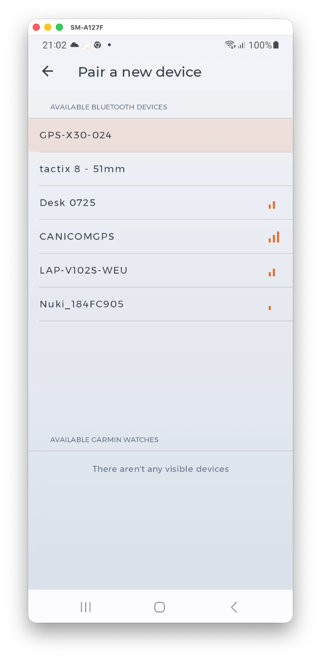
Collar Pairing
Collar pairing remains similar to before, but we moved it to the “Integration” tab in the settings. And more settings options have been added. For the record, Garmin collars continue to pair with the HUNTERRA app via Garmin watches and the HUNTERRA or Tracker+ apps, both of which are free to download via Garmin Connect IQ.
After pairing the handheld (“transmitter”), a list of dogs that are saved will be displayed, and the user can choose which ones they want to display in the HUNTERRA app. Their number is not limited in HUNTERRA.
Dog profile
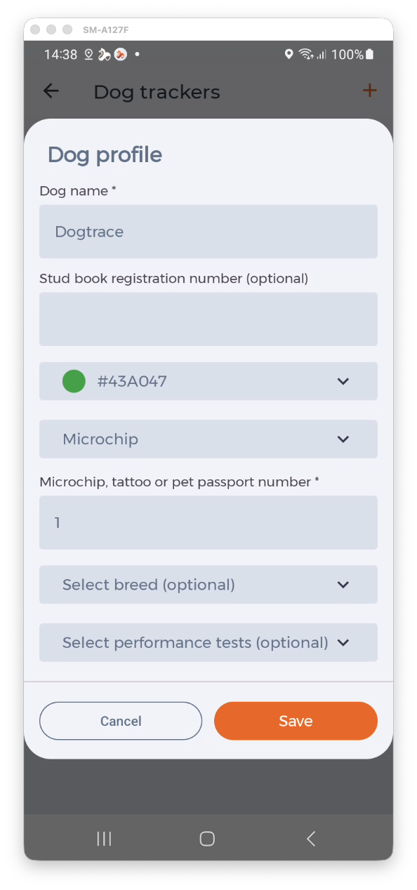
After pairing, the user has the option to set details about their dog. In particular
- the dog’s name,
- the color of its collar (and trajectory),
- the dog’s breed,
- the dog’s identification (the dog can choose between a microchip, pet passport number or tattoo),
- the dog’s registration in the central registry (for integration into digital records),
- the dog’s performance tests passed.
The details can be changed at any time. They are important not only for the registry itself but also so that the hunting ground owner or gamekeeper can include the dog in the hunting ground’s pedigree and subsequently generate a Mysl6 report from the dogs stored in this way. As you are already used to with HUNTERRA, legal records are just a by-product.
It is worth adding at this point that dogs are only displayed to the hunting ground user or gamekeeper if their leader is a member of the hunting ground and has the “Dog Leader” role assigned.
Advanced dog information
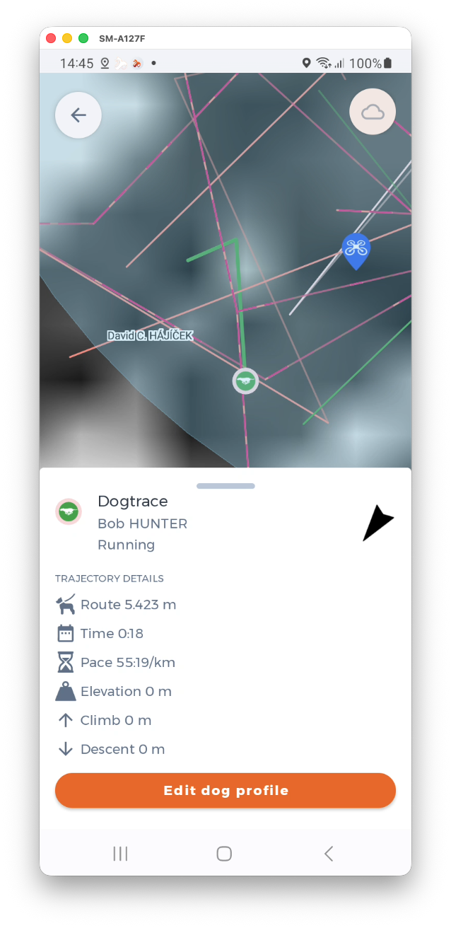
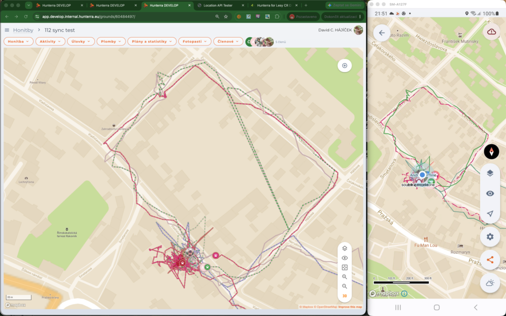
The reason for entering details about the dog is more prosaic – the entered name and dog ID will help with joint hunts, similar to the chosen color. The chosen color is used to plot the dog’s trajectory, which the handler sees. Other users then see a dashed line where the color of the dog and its handler alternates. At events where we all arrive with an orange or yellow collar, everyone knows at first glance who the dog belongs to.
In the dog’s card, which opens after clicking on its avatar on the map or on the trajectory, the handler sees other useful information – its status (exhibiting, sitting, running, etc.), message (barking) or speed, distance covered or elevation. They also see a directional arrow showing where the dog is.
The dog’s status is also displayed directly in its avatar on the map.
Only the dog’s handler can see the details listed. Others can only see the dog’s color and name.
Active recording of “shoe trails”
Until now, saving hunting trails, slopes and walkways was a semi-manual process – it was possible to create a permanent map element from the recorded route, but now it is even easier – just click a button on the trajectory card, and a shoe trail or walkway will be automatically created from the recorded route.
Additional integrations
In addition to other collar manufacturers, other drone models have also been added. We can boast support for the Autel Enterprise UAV series.