

Drones over the hunting ground
A drone linked to the hunting ground: photos and findings land straight in the map, missions are planned from the computer, and the imagery becomes your own orthophoto map.
HUNTERRA can link a drone to a particular hunting ground. Once you sign in from the controller, every manually taken photo and every marked point is saved into that ground's map and all its members can see them. Flight missions are planned in the web app: you draw the area, choose the mission type and its parameters, and the mission is sent to the controller. Both DJI and Autel drones are supported, each connecting a little differently.
Findings straight in the map
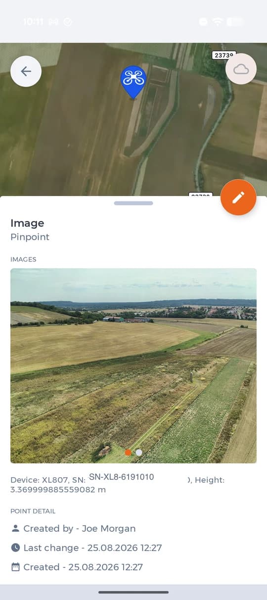
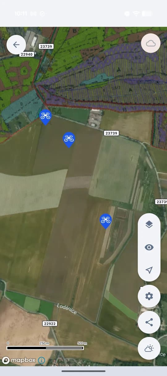
A drone photo and a marked spot are saved into the ground map with a time and an author. Nobody forwards anything and the others see it at once.
Missions from the computer
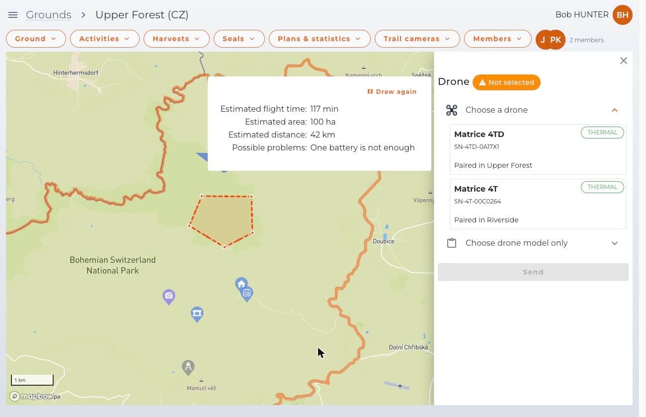
You draw the area on a large map at the computer, not with a thumb on the phone. The app works out the flight time and warns you when one battery will not be enough.
Your own orthophoto map
A mapping mission flies the area so that an orthophoto map can be assembled from it. The processing is done to order, block by block.
A flight mission from the web app
In the ground map you draw the area, pick the paired drone and the mission type, and set the altitude, speed, overlap and temperature threshold. The app keeps recalculating the estimated flight time, area and distance. Once sent, the mission is waiting in the controller under the Cloud tab.
Findings in the hunting ground map
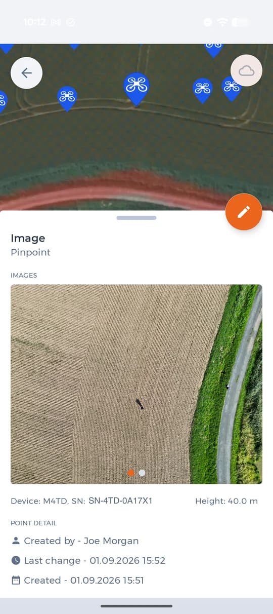
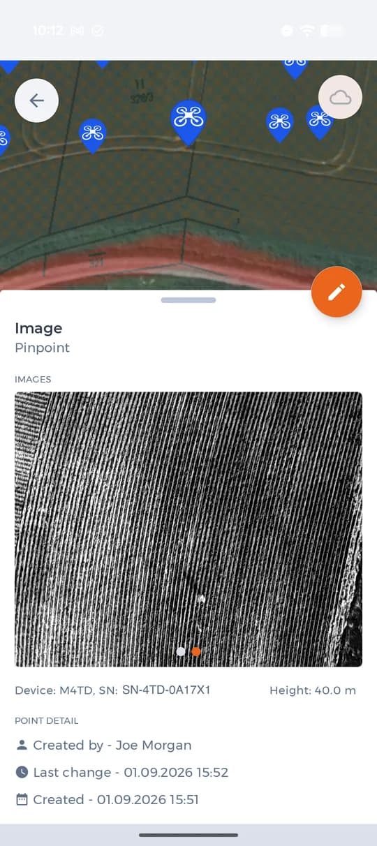
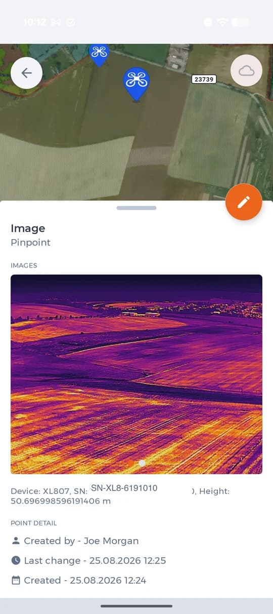
Every drone photo is saved as a point in the hunting ground map — with the time, the author, the drone type and the altitude it was taken from. On thermal images you also see what the naked eye cannot make out from up there.
A person in a field from fifty metres up
On the ordinary image the figure is a barely noticeable dark streak. The thermal camera turns it into a bright spot you cannot miss — that is why missions searching for people are flown with thermal. Drag the slider and compare the two images of the same spot.
The same landscape twice
Thermal is not only for searching. On a field it shows where the harvest is done, where the machinery drove and where the heat lingers — on an ordinary image you would be guessing.
Three mission types
Game
A patrol mission — the drone transmits only the findings, not the whole video, and the game is written into the map as points. Requires a drone with a thermal camera.
People
A patrol mission as well, but looking for people; the findings are evaluated by AI. Useful in a search and when checking movement in the hunting ground.
Mapping
The drone flies the area for an orthophoto map. Note: a mapping mission transfers a large number of images, so manually taken photos wait in the queue until everything has been uploaded. Mapping missions work only with DJI drones; Autel does not support them.
Connecting the drone

On the controller, in DJI Pilot 2, choose Cloud services → Open platforms and enter the address drone.hunterra.eu. After signing in you pick the hunting ground, and from then on the photos and points are saved into it.

Autel Enterprise is not set up by hand. The details for Cloud Service on the Smart Controller are generated by the page drone.hunterra.eu/autel.html: you sign in with your HUNTERRA account, pick the hunting ground and the page lists the values you simply copy into the controller. The photos are then synchronised into the map just as with DJI.
Why don't I see the points with photos in my map
The most common reasons a point from the drone does not appear in the hunting ground map, from the most common to the least likely.
The drone has no position fix
Without a GNSS (GPS) signal, refined by RTK where available, the image has no coordinates and HUNTERRA has nowhere to place the point. Check on the controller that the drone has a position fix and take the picture again.
A mapping mission is running
Images from an automatic mapping mission go to processing into the orthophoto map and the 3D model, not into the map as individual points. There are also a lot of them: DJI devices cannot give manually taken photos priority in the transfer, so they wait until the whole batch has uploaded. Until the queue shows zero, the point will not show up in the map.
You are looking at a different hunting ground
Photos and points are saved into the hunting ground you picked when signing in from the controller. Check that you have the same one open in the app.
The connection to the cloud has dropped
On the controller, sign out of the HUNTERRA cloud and sign in again. That restores both the connection and the choice of hunting ground.
