

Hunting maps
A map that knows where the hide, the feeder and the ground boundary are.
A tourist map is not enough. This one is built for the ground.
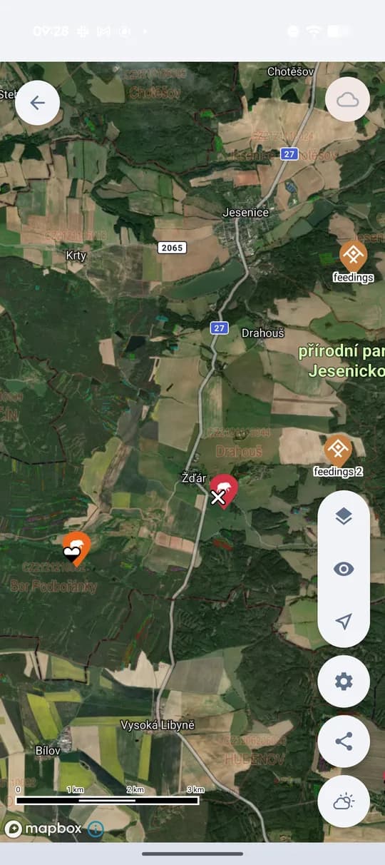
HUNTERRA is built on a hunting map base: forest roads and rides, hunting facilities, terrain and — in countries where the data exists (Czechia, Slovakia, Poland, Croatia, Slovenia) — predefined hunting ground boundaries. Three base layers come as standard: Main, Outdoor and Satellite. You can add your own map sources and overlay layers with adjustable transparency on top of them, and download all of it to the phone for use without a signal.
What the map does for you
Five reasons the map is there in the first place.
A real hunting map
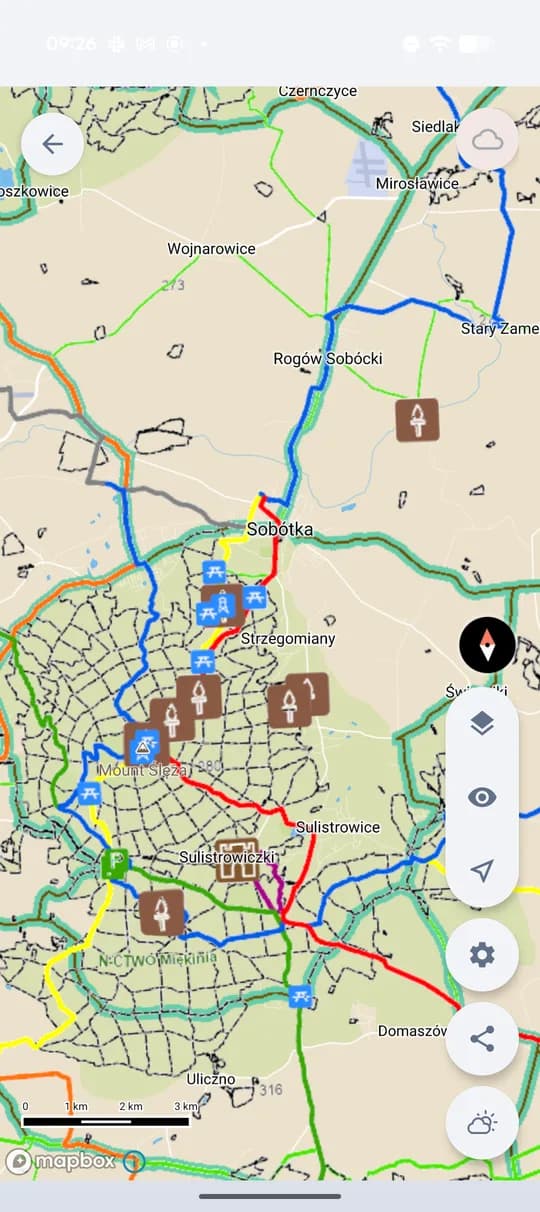
The base is not a tourist map full of cycling routes. It shows forest roads and rides, hunting facilities, contour lines and terrain — what you actually navigate by in the field. In Czechia, Slovakia, Poland, Croatia and Slovenia you can add predefined hunting ground boundaries.
Three base layers as standard
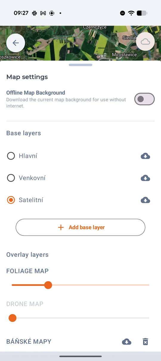
Main, Outdoor and Satellite. One tap switches between them: satellite for cover and crops, outdoor for terrain, main for everyday orientation. Each has a download icon — it is stored on the phone for use without a signal.
Your own map source
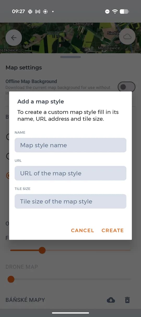
If you have your own map service, add it. All it takes is a name, the tile service URL and the tile size — an orthophoto from a national provider, or a layer supplied by the forest administration.
Overlay layers with transparency
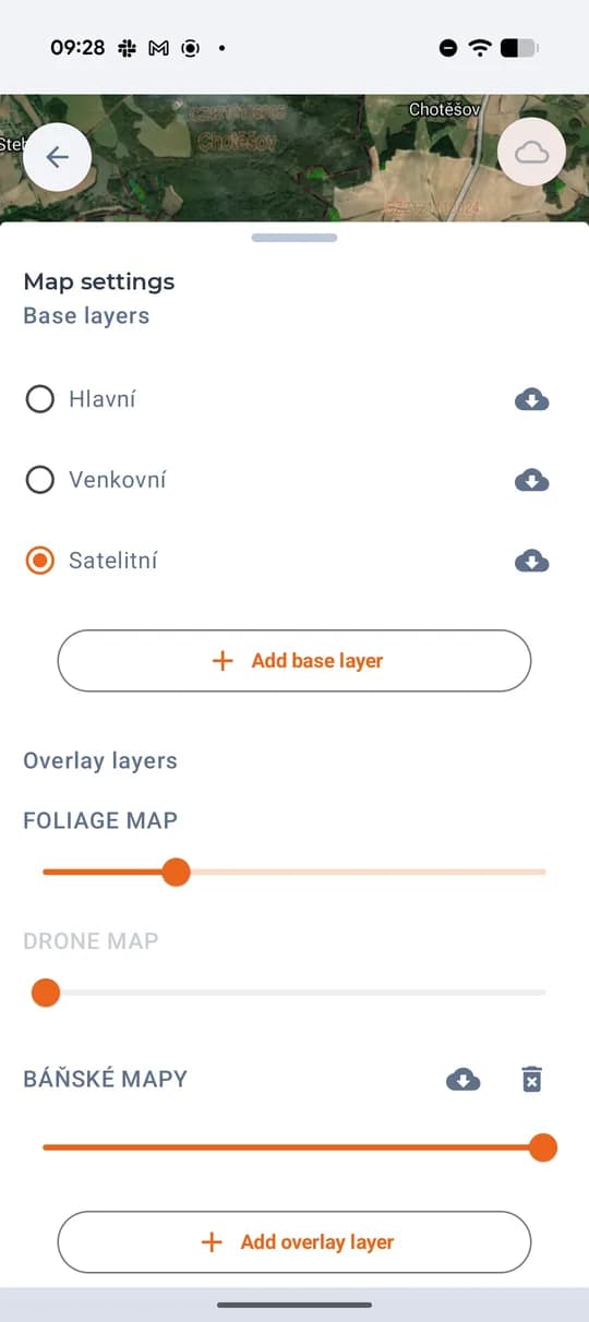
More layers go on top of the base — a foliage map, an orthophoto from your own drone, mining maps. Each has a transparency slider, so you decide how much of it shows, and it can be downloaded to the phone or deleted.
Points of interest right in the map
Feeders, hides, pulpits, findings and harvests each have their point and icon, so you know what is where in the ground. On the satellite layer cadastral boundaries and parcel numbers line up with them.
Your plan decides how many layers you get
Free and Basic come with two base layers, Basic adds one overlay layer. Premium has base and overlay layers without limit and is the only plan with offline maps.
- Unlimited base map layers
- Unlimited overlay layers
- Offline maps (6,000 tiles)
- Your own map sources
- Unlimited hunting ground maps
- Filter points of interest by type, time and author
