

Hunting ground and members
Invite people with a code, give each of them a role, and draw the boundary exactly where it runs.
A ground is not just an outline on the map. It is the people in it.
A hunting ground in HUNTERRA has its boundary, its facilities and its people. Members are invited with a numeric code and each of them gets one or more of the 8 roles — from the landlord and the manager to a guest hunter, a dog handler or a game warden. Every role carries its own set of rights, so a guest sees the ground but does not rewrite it. Roles can be changed at any time, a member can be removed, and the boundary can be redrawn vertex by vertex.
Invitation is one code
The ground has a sharing code. You send it on, the other person enters it and is in — no e-mail lists, no waiting for an administrator. The code can be regenerated, and the old one stops working.
8 roles, each with its rights
The manager, the delegated hunter, the guest, the dog handler and the game warden do not need the same things. Roles combine, so one person can be both the landlord and the manager.
The boundary as it really runs
The outline is drawn into the map as a polygon and edited vertex by vertex, so it follows the rides and the field edges instead of a rough approximation.
Inviting people and setting roles
Three steps in the ground's settings — you do not need a computer.
Open the ground's settings
In the ground detail you find its name, people, bookings, ground trail cameras, the boundary and offline availability — everything about the ground in one place.
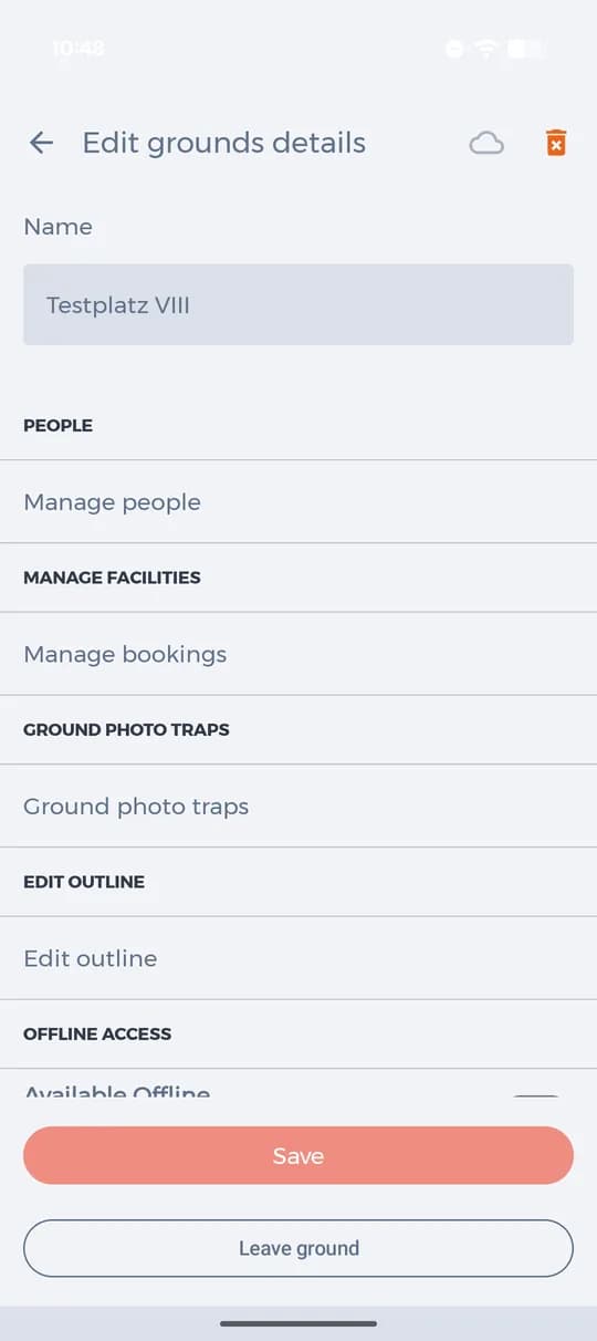
Settings of one ground. Send the sharing code
Under People there is a numeric code. Anyone who has it can see the ground's detail but cannot edit it. The circular arrow generates a new code when the old one has spread too far.
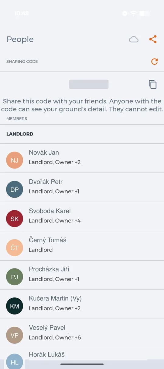
The sharing code and the list of members with their roles. Give each member their roles
Tap a member and tick the roles that belong to them. The same screen removes the member from the ground when they no longer belong to it.
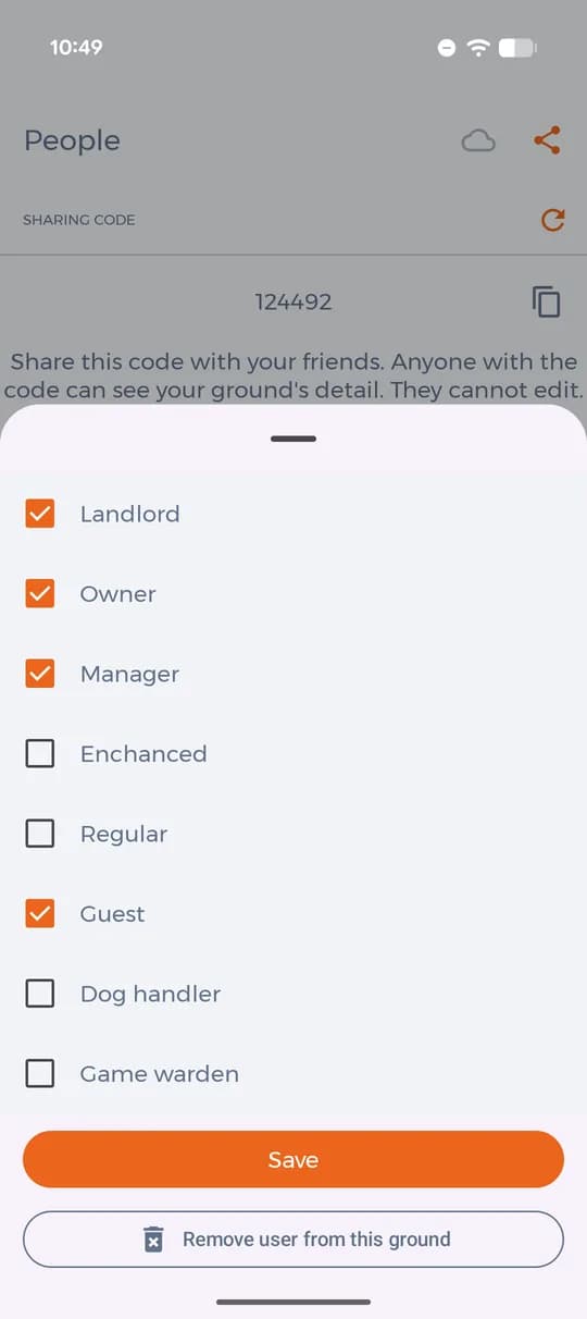
Choosing the roles of one member.
8 roles
Roles are ticked, not chosen one at a time — one person can be the landlord and the manager at once. Each of them carries its own set of rights.
- Landlord
- Owner
- Manager
- Enhanced hunter
- Regular hunter
- Guest hunter
- Dog handler
- Game warden
The boundary of the ground
The outline is drawn as a polygon and can be corrected whenever the ground changes.
Drag the vertices where the boundary runs
Open Edit outline in the ground's settings. Each vertex can be dragged or deleted, so the line follows the ride, the field edge or the road. Then confirm with Done.
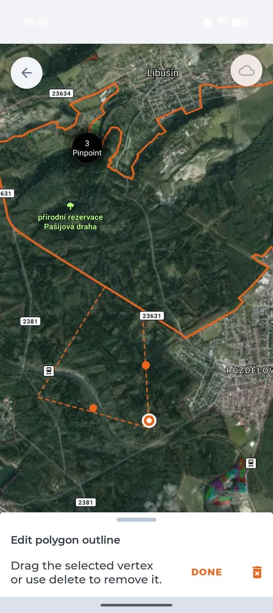
Editing the outline of the ground. The ground has its shape
The finished boundary shows in the map for every member, and points of interest, areas and drives are placed inside it.
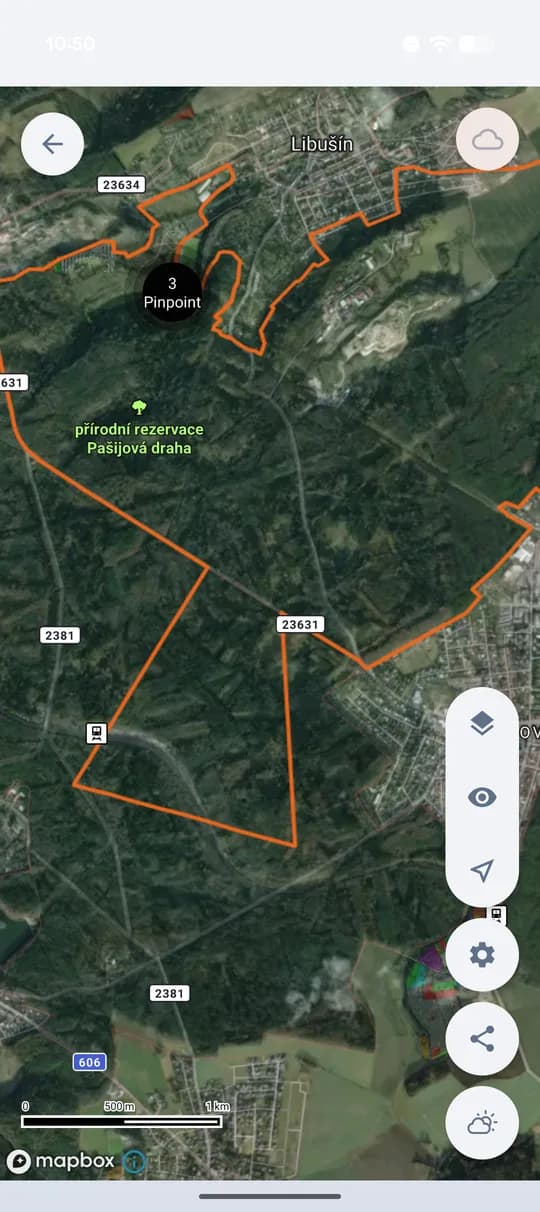
The finished boundary in the map.
Grounds and members by plan
You can create a ground on every plan. The plan decides how many ground maps, events and members you can have.
- Unlimited ground maps, events and members
- Unlimited base maps and overlay layers
- Offline maps for use without a signal
- Unlimited photos on points of interest
- Filter points by type, time and author
- Connect your own trail camera
