

Connecting an Autel drone
The Cloud Service values are generated by drone.hunterra.eu/autel.html — just copy them into the controller and photos from the drone start landing in your ground map.
Autel Enterprise is not set up by hand. On drone.hunterra.eu/autel.html you sign in with your HUNTERRA account, pick a hunting ground or an event, and the page prints the values for Cloud Service on the Smart Controller. Once connected, every photo from the drone syncs to the cloud and shows up as a point in the ground map — just like with DJI.
Before you start
You'll need an Autel EVO Max series drone (4T or 4N) with firmware V1.8 or newer — per Autel's documentation, Cloud Service is supported by this series only (Autel Enterprise app V2.4.15+). You'll also need a HUNTERRA account with a hunting ground and internet on the controller — without it, the controller can't sign in to the cloud.
Open the credentials generator
In a browser, open drone.hunterra.eu/autel.html and sign in with the same account you use for HUNTERRA.
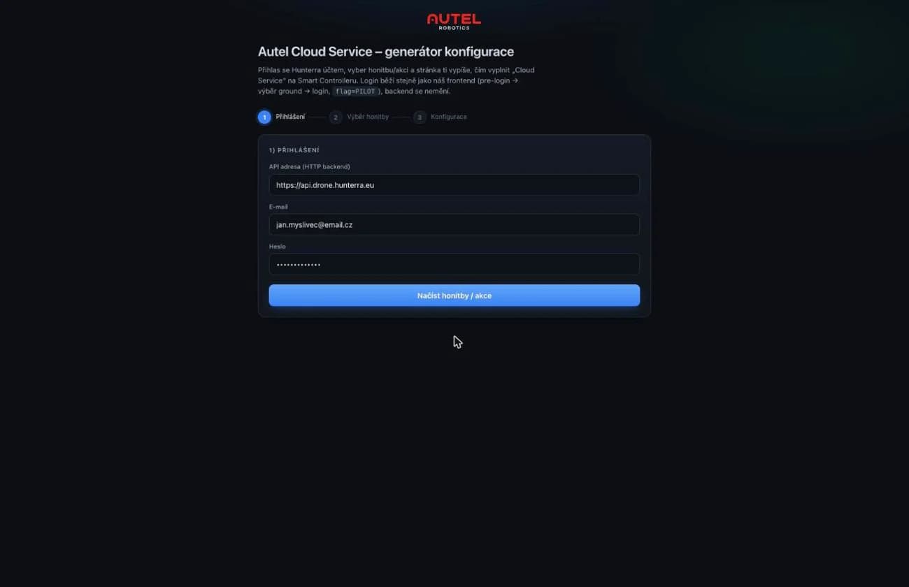
Signing in with a HUNTERRA account on drone.hunterra.eu/autel.html Pick a hunting ground or event
Choose where the drone photos should go. The points will then appear in the map of that ground.
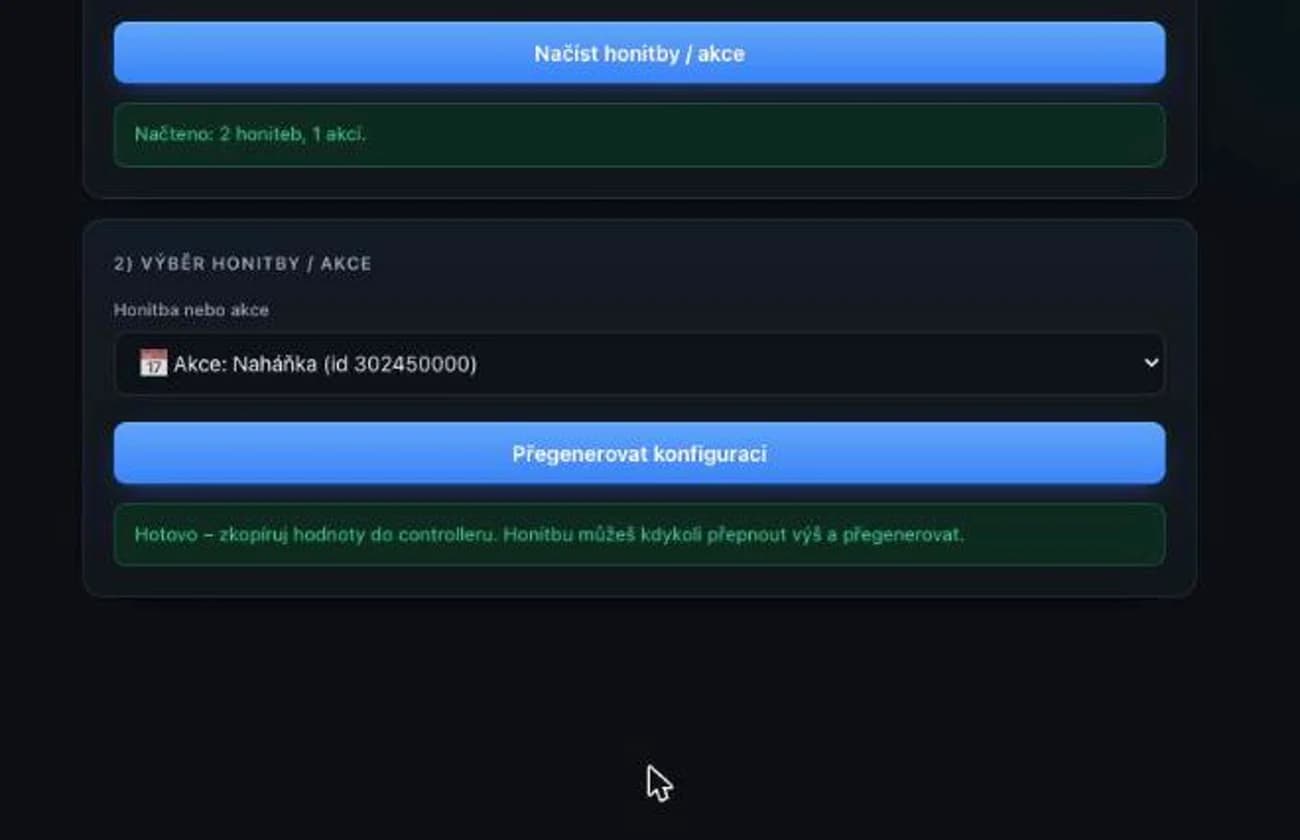
Choosing the hunting ground the photos will be stored in Let the page generate the values
The page prints the Cloud Service values. Nothing is made up by hand — everything the controller needs is right there.
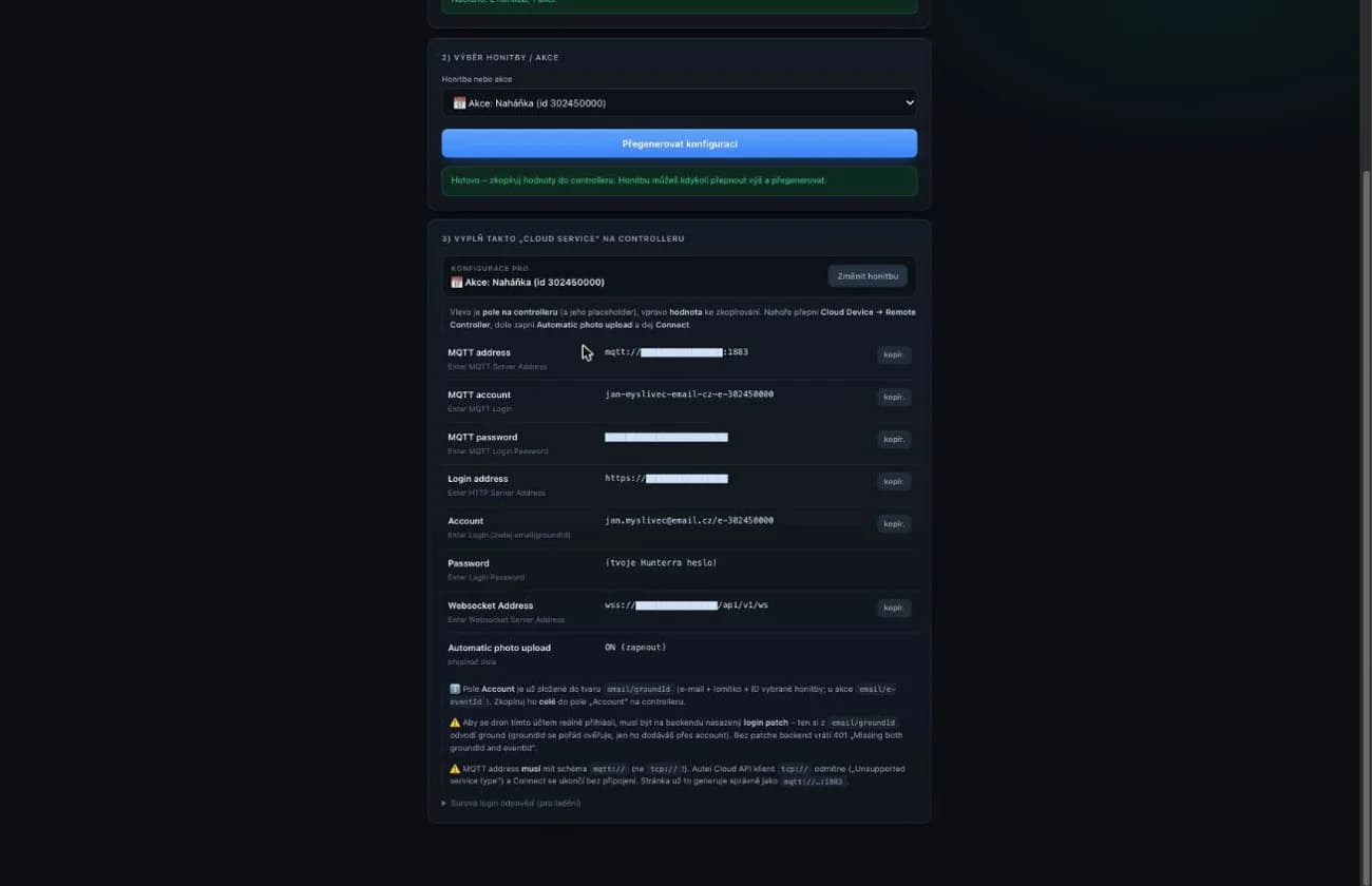
Generated values for Cloud Service Open Cloud Service on the controller
On the Smart Controller, tap Menu in the top right corner and choose Cloud Service in the Information Sharing section. Keep the Remote Controller tab selected at the top.
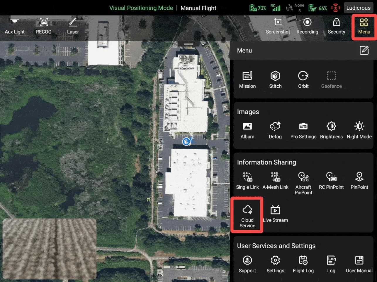
The controller menu — Cloud Service in the Information Sharing section (Autel Robotics material) Fill in the values and connect
Copy the values from the generator, tap More and fill in the remaining fields too. Then switch Automatic photo upload to ON and tap Connect — the status switches to Connected and the controller remembers the settings.
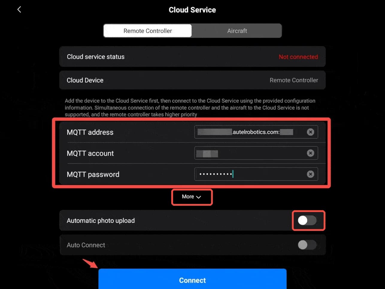
Cloud Service in Autel Enterprise — filled-in fields, More with the remaining values, the Automatic photo upload switch and the Connect button (Autel Robotics material) Photos sync on their own
From then on, every photo from the drone uploads to the cloud and shows up as a point in the ground map — with coordinates, time and a preview.
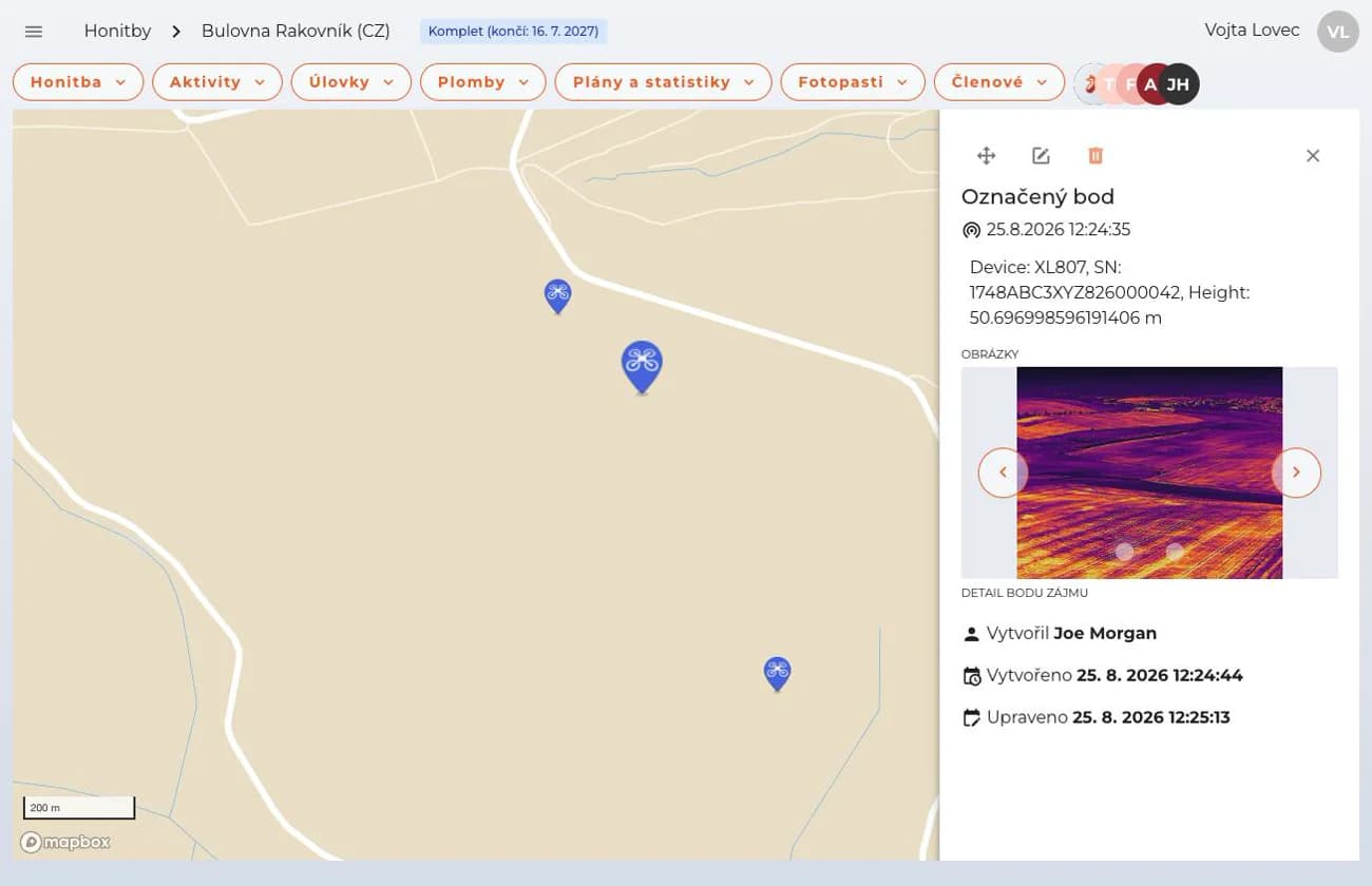
A point with a drone photo in the ground map

Live sync depends on the controller's internet
The drone itself has no SIM card — photos travel from the drone to the controller, and it is the controller that sends them to the cloud over its own connection: Wi-Fi, a phone hotspot, or an optional 4G module with a SIM. The drone-to-controller link matters too: photos travel over the same radio link as the live view, so with the drone far away or behind terrain the transfer gets delayed. Nothing is lost — the photos upload once the drone is back closer and the controller is online, typically after the flight. Points appear in the map live only with a strong link and the controller online during the flight.
More on Autel's site: Cloud Service in the Autel Enterprise app · Drone-to-controller link: SkyLink 3.0 · 4G integration for EVO Max · What a 4G LTE dongle is
Why I can't see photo points in my map
The most common reasons a point from an Autel does not appear in the ground map, from the most likely to the least.
The controller is offline, or the drone is too far
It is the controller, not the drone, that sends photos to the cloud — and from the drone they travel to the controller over the same radio link as the live view. Without internet in the field, or with the drone far away or behind terrain, the sync gets delayed and catches up after the return — check Wi-Fi, the hotspot or the 4G module.
More on Autel's site: Cloud Service in the Autel Enterprise app · Drone-to-controller link: SkyLink 3.0 · 4G integration for EVO Max · What a 4G LTE dongle is
The drone has no position fix
Without a GNSS (GPS) signal, or RTK, the photo has no coordinates and HUNTERRA has nowhere to place the point. Check on the controller that the drone has a position fix and take the photo again.
You are looking at a different ground
Photos go to the ground selected when the values were generated on drone.hunterra.eu/autel.html. Check that you have the same one open in the app — for a different ground, generate new values.
The cloud connection dropped
In Autel Enterprise, disconnect from Cloud Service and connect again. If that does not help, generate fresh values on drone.hunterra.eu/autel.html and enter them into the controller.
Mapping missions (orthophoto) are currently supported only on DJI drones — Autel connects to HUNTERRA for photos and findings in the map.
